Cedar Mountain
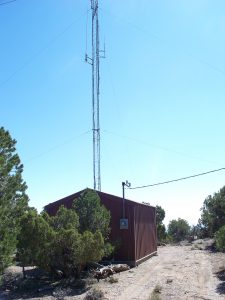
Cedar Mountain is located along the northern region of the San Rafael Swell in Eastern Utah. The GPS coordinates for this repeater are:
N 39° 10′ 16.32″
W 110° 37′ 12.74″
7659 ft Elevation
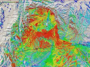
CEDAR MOUNTAIN COVERAGE MAP »
Cedar Mountain Repeater
This repeater site is located in Emery County, Utah in the San Rafael Swell region of Utah. It is on the southern edge of Cedar Mountain which sharply drops and overlooks the San Rafael Desert. This repeater consists of a VHF repeater (ERP 100 w) and a UHF repeater which links back to Bruin Point.
This repeater covers south towards Interstate 70, east to Green River, UT, north towards Price, UT, and west to Castle Dale, UT. Some have even used this repeater from Moab, UT with a gain antenna and power.
“NEW” This site is also the home for the 147.120 Repeater WHICH IS NOW permanently Linked to the “Intermountain Intertie”

Repeater Access Information Repeater Callsign: K7SDC Output Frequency: 147.140 MHz Input Frequency: 147.740 MHz Offset: +600 kHz Status: Open CTCSS: 88.5 Hz (NOW LINKED) Intertie Repeater Access Information Repeater Callsign: WX7Y Output Frequency: 147.120 MHz Input Frequency: 147.720 MHz Offset: +600 kHz Status: Open CTCSS: 100.0 Hz |
